

Plan your outdoor adventures around the California capital with our list of the best hikes around Sacramento. Put on your boots, slap on the sunscreen, and discover some beautiful Northern California landscapes. We've put together six trails to explore this spring. Even if you’re not into hiking, many of these trails can be tackled by biking or walking!
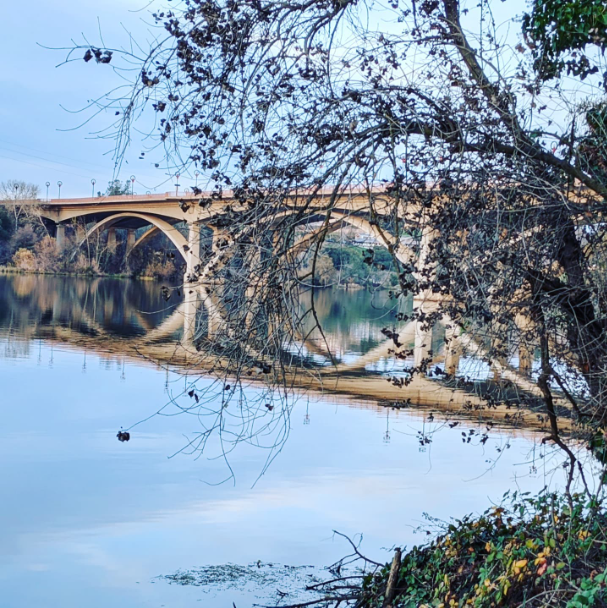
Photo: Jedediah Smith Trail by @luluflores_e
JEDEDIAH SMITH TRAIL (AMERICAN RIVER BIKE TRAIL)
Spring is the perfect time to go out for a nice bike ride, and Jedediah Smith trail is a great choice. Generally considered an easy route, it takes an average of 11 hours and 39 minutes to complete. This trail is pleasant, with nice views of the river. It begins at Discovery Park in downtown Sacramento, and ends 31 miles away in Beal's Point in Folsom. There are several points of entry, so you don’t have to complete the trail in its entirety.
https://tinyurl.com/4zfvawc9
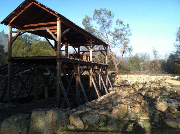
MARSHALL GOLD DISCOVERY STATE HISTORIC PARK
This area was known as the “beautiful valley,” originally inhabited by the Nisenan Indian tribe. Over time, it became a hotspot during the California Gold Rush. With its rich history, Marshall Gold Discovery State Park is the perfect trail to take a stroll. The best part– it’s only three miles long and is 45-minutes outside of Sacramento.
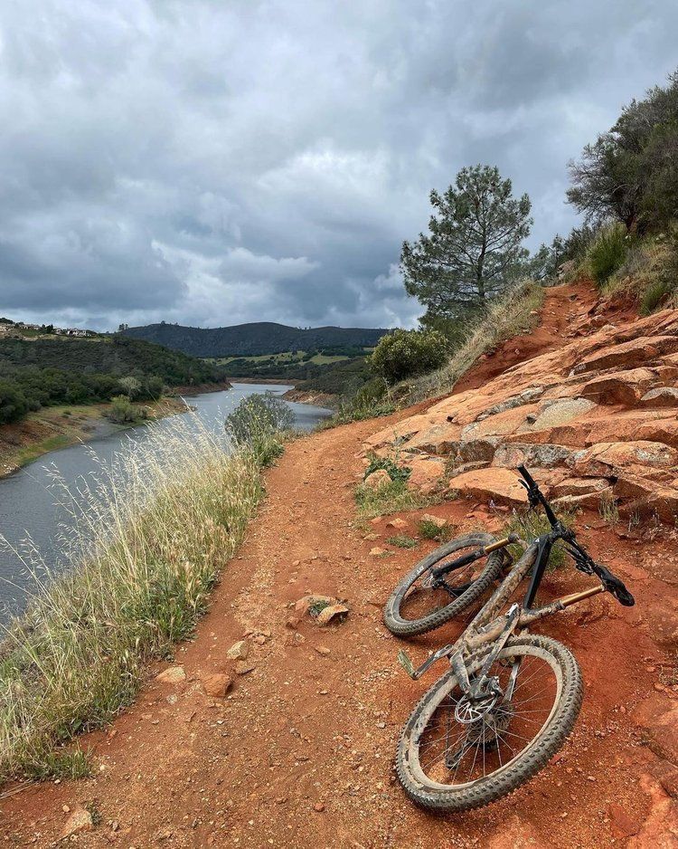
Photo: Darrington Trail by @sactownjesse
DARRINGTON TRAIL, FOLSOM LAKE STATE RECREATION AREA
Salmon Falls, also known as the Darrington Trail, is on the South Fork of the American River within the Folsom Lake State Recreation area. This trial is popular for both hikers and mountain bikers alike. Considered a moderately challenging route, it takes an average of 8 hours to complete, so we recommend bringing plenty of water while you soak up the gorgeous views of the American River Valley.
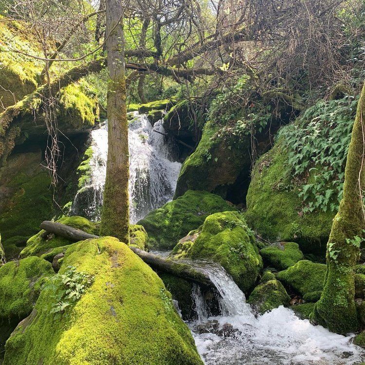
Photo: Quarry Trail by Chris Aguilar
THE QUARRY TRAIL, AUBURN STATE RECREATION AREA
Located in the Auburn State Recreation area lies one of Sacramento’s most beloved trails. Quarry Trail is a 10-mile hike that is a wonderful escape into nature. Considered moderate difficulty it's perfect for both hikers and bikers. It’s also a fantastic place for viewing wildlife, with the potential to see bobcats, bears, deer, and more. The Quarry Trail has numerous opportunities for side hikes and loops, including junctions with the historic Western States Trail. Other scenic trailheads extend from the Quarry Trail parking area, including a short trail that leads to No-Hands Bridge.
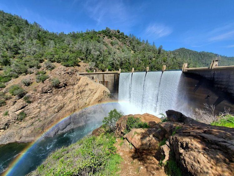
Photo: Lake Clementine Trail by Zach on Instagram
LAKE CLEMENTINE, AUBURN STATE RECREATION AREA
Lake Clementine is one of the multi-use trails in the Auburn State Recreation Area. Consider an easy trail of just two miles, it follows the banks of the North Fork of the American River and includes impressive views of the Foresthill Bridge, one of the tallest bridges in California. Following Lake Clementine Road for less than a quarter-mile, a cascading view of Lake Clementine Dam greets hikers near the end of the trail, complete with a constant mist-shrouded waterfall. This overlook is a great place to eat some lunch before hiking the two miles back to the trailhead.
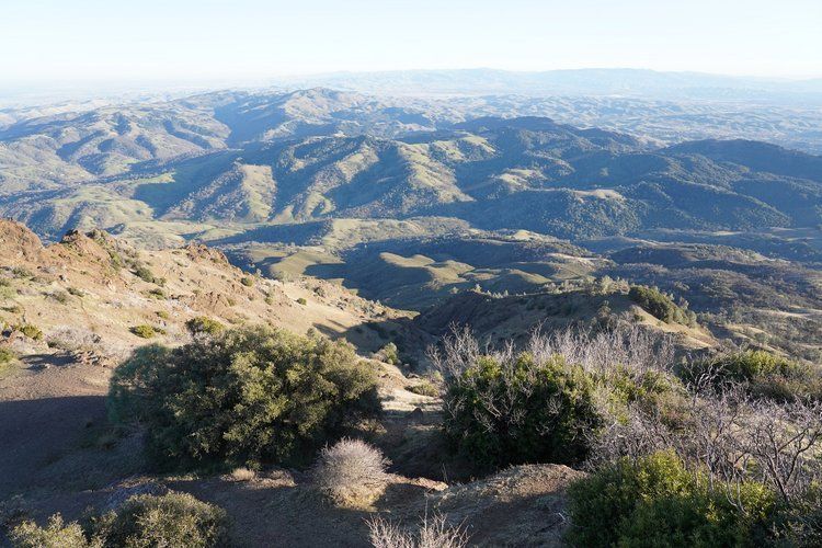
Photo: Mount Diablo Summit by calparks.org
MOUNT DIABLO SUMMIT, MOUNT DIABLO STATE PARK
Last on our list is a popular trail known to be one of the most challenging hikes near Sacramento. Mount Diablo Summit is located in its namesake Mount Diablo State Park. The trail quickly rises to show off abundant views of the mountains and hills below, and on clear days, you can see out for miles and miles. It’s a strenuous workout to get to the top, and the trail is quite exposed with very little shade or cover. We recommend exploring this trail before the summer months, but come prepared with water, a hat, sunglasses, and lots of sunscreens to protect yourself.